|
|
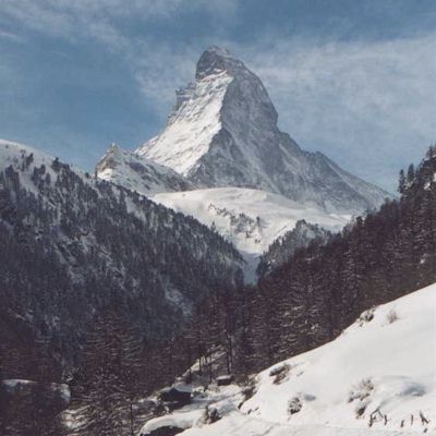
Matterhorn |
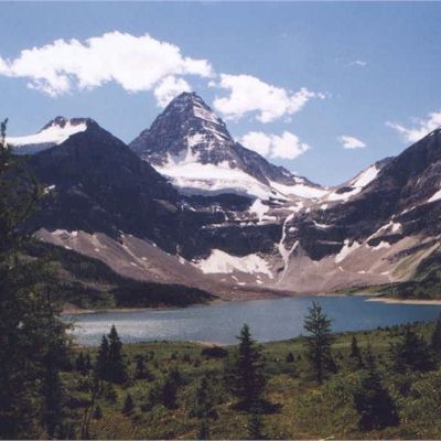
Mt. Assiniboine |
45°58' N / 7°43' E |
50°52' N / 115°39' W |
4478 m (14'690 ft) |
3618 m (11'870 ft) |
Matterhorn (Switzerland) and Mt. Assiniboine (Canada)
|
|
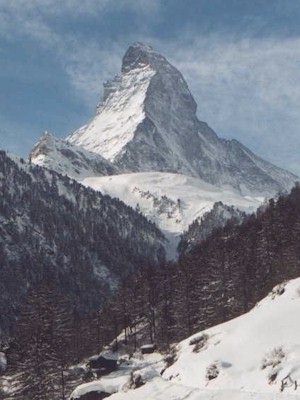
Matterhorn |
Mt. Assiniboine |
45°58' N / 7°43' E |
50°52' N / 115°39' W |
4478 m (14'690 ft) |
3618 m (11'870 ft) |
Mt. Assiniboine is often referred to as Canada's Matterhorn. The two mountains, separated by ca. 13'500 km, resemble each other quite a bit - even more so when standing right in front of one of them without seeing the other one at the same time. In a direct comparison, as shown in the two pictures, Mt. Assiniboine is not as pointed as the Matterhorn. With today's technology this can be fixed easily, of course:
|
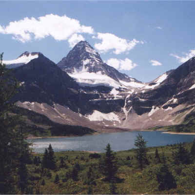 |
| unchanged | Mt. Assiniboine |
Both mountains are very popular with mountain climbers, and both have apparently a very similar level of difficulty, except that the air gets a little thinner on top of the Matterhorn. The Matterhorn is easily accessible by train from Brig to Zermatt and, if a closer look is desired, by Gondola right to the base of the mountain. The base of Mt. Assiniboine can be reached by a ca. 30 km, 2 to 3 day hike (one way) from Sunshine Village near Banff, or in about the same time from the Mount Engadin Lodge in Kananaskis. As a third option, it can also be reached by helicopter, which is a bad way of doing it as the hike in and out is absolutely gorgeous.